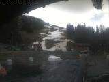
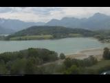
Weather Webcam Gruyères (Greyerz, Freiburg)
Slide-Show
Quick-Facts
Webcam "Weather Webcam Gruyères (Greyerz, Freiburg)" |
|
|---|---|
| save selected picture | |
| Location of Webcam: | Show on map |
| Webcam-Coordinates: | 46.581500 / 7.076270 |
| Altitude over sea: | 786m |
| Weather-Webcam-Motiv: | n/a |
| Newest Webcam-Picture: | 27.04.2025 18:07:03 |
| Webcam-Source: | to sourcewebsite |
Infos about Gruyères |
|
| Sunrise: | 06:20 hours |
| Sunset: | 20:37 hours |
| Sights in Gruyères: |
|
| Famous Waters: | |
| Famous Mountains: |
|
| Touristic Regions: | |
| Wikipedia: | Gruyères |
Infos about Gruyères
Weather Webcam Gruyères (Greyerz, Freiburg)
In Gruyères, there is the Webcam Weather Gruyères (Greyerz, Freiburg).
Enjoy the slideshow of this weather webcam.
The webcam Gruyères is regularly updated with new pictures.
Track the current weather in Gruyères Greyerz with the webcam GRUYèRES.
Gruyères is located at 810 meters above sea level. M., 4.5 km south-southeast of the district chief town cop. The historic town extends on an isolated hill at the northern edge of the Alps, at the northeastern foot of the Moléson and the point where the Sarine leaves the Fribourg Alps.
The area of 28.4 km² large municipality area includes a portion of the Saanetals and Fribourg Alps. The central part of the region is the alluvial plain of the Sarine. At the edge of the Alps between Gruyères and Broc, from the hill of Gruyères rises. This river flows from the west of the mountain brook Trême. East of the Sarine the municipality bottom ends in a narrow corner bounded by rocky ridges Dent de Broc in the north and Dent du Chamois in the south to in the Motélontal. The two prominent rock peaks with the intervening saddle are a popular photographic subject of Gruyères from. Gruyères.


.jpg)
.jpg)
.jpg)


.jpg)

.jpg)
