Weather Webcam Anger
Slide-Show
Quick-Facts
Webcam "Weather Webcam Anger " |
|
|---|---|
| save selected picture | |
| Location of Webcam: | Show on map |
| Webcam-Coordinates: | 47.803764 / 12.857849 |
| Altitude over sea: | 536m |
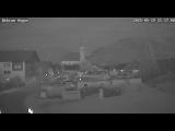
| Weather-Webcam-Motiv: | Dorfplatz von Anger |
| Newest Webcam-Picture: | 18.04.2025 20:29:01 |
| Webcam-Source: | to sourcewebsite |
Infos about Anger |
|
| Sunrise: | 06:08 hours |
| Sunset: | 20:06 hours |
| Sights in Anger: |
|
| Famous Waters: |
|
| Famous Mountains: |
|
| Touristic Regions: |
|
| Wikipedia: | Anger |
Infos about Anger
Weather Webcam Anger
In Anger, there is the Webcam Weather Anger with motif: Dorfplatz von Anger.
Enjoy the slideshow of this weather webcam.
The webcam Anger is regularly updated with new pictures.
Track the current weather in Anger with the webcam ANGER.
Anger is a municipality in the Upper Bavarian district of Berchtesgaden in Germany near the A8 Munich-Salzburg motorway. In the municipality of Anger is also the former monastery Höglwörth, one of the most romantic sacred in Rupertiwinkel. The town of Anger between the ridge of the Högl and the Stoißberg, a spur of Hochstaufen Mountain stick and extends from approximately 470 m above sea level. NN (district Jechling) to a height of 827 m at 1,333 m Högl and at the highest point of the municipality, the "cutting" on Teisenberg on the municipal boundary to Teisendorf. The biggest river in the municipality of Anger is the Stoißer Ache, the largest lake in the Lake Höglwörther. Ask about is viewing the current weather conditions in Anger with our weather weather Webcam!


