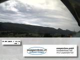
Weather Webcam Laupersdorf
Slide-Show
Quick-Facts
Webcam "Weather Webcam Laupersdorf " |
|
|---|---|
| save selected picture | |
| Location of Webcam: | Show on map |
| Webcam-Coordinates: | 47.312861 / 7.653758 |
| Altitude over sea: | 494m |
| Weather-Webcam-Motiv: | n/a |
| Newest Webcam-Picture: | 18.04.2025 23:04:03 |
| Webcam-Source: | to sourcewebsite |
Infos about Laupersdorf |
|
| Sunrise: | 06:32 hours |
| Sunset: | 20:24 hours |
| Sights in Laupersdorf: |
|
| Famous Waters: |
|
| Famous Mountains: |
|
| Touristic Regions: |
|
| Wikipedia: | Laupersdorf |
Infos about Laupersdorf
Weather Webcam Laupersdorf
In Laupersdorf, there is the Webcam Weather Laupersdorf .
Enjoy the slideshow of this weather webcam.
The webcam Laupersdorf is regularly updated with new pictures.
Track the current weather in Laupersdorf with the webcam LAUPERSDORF.
Laupersdorf is a municipality in the district of Thal in the canton of Solothurn in Switzerland. Lauper village is situated at 493 meters above the sea, 3 km west of the district main village Balsthal. Lauper village is located in a protected position in the hollow of the village stream on the sunny side at the northern edge of the valley of the Balsthalertals, at the foot of the mountain range Brunner in the Jura Mountains. With 1,683 inhabitants Lauper village belongs to the medium-sized municipalities of the canton of Solothurn. Take a look after Höngen via our weather Webcam.
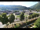
Weather Webcam Lauper village, looking towards Weissenstein / Jura: Keep up with the time-lapse weather Webcam live weather Lauper village, looking towards Weissenstein / Jura. View towards Matzendorf, Aedermannsdorf, Herbertswil and Welsch tube. Left picture are Rüttelhorn (1192m), Chamben (1251m) to see Röti (1395m) and white stone (1303m).
Video
Video weather Webcam Laupersdorf
Slideshow video of weather Webcam Laupersdorfvideo created on 02.12.2014 17:59


.jpg)


.jpg)
.jpg)
.jpg)
.jpg)
